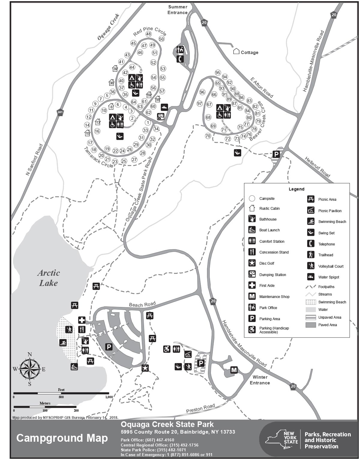
Oquaga Creek Map Location
Use the +/- zoom controls and the 'Satellite' button to get a closer view of the campground (and potentially identify specific
sites)
Loading map, please wait...
Legend
 Front Gate
 Beach
Beach Site 74
 Site 20
 Beaver Creek Circle
 Tamarack Circle
 Red Pine Circle
Photos were taken on a rainy day in the spring on May 17, 2016. As such consider that the leaves on the trees are not fully out. If you are camping at Oquaga Creek in the summer, you can assume that there will be more shade and site privacy on sites that have deciduous trees. Due to the rain I didn't take as many photos as I would have liked of each campsite. It was also a dreary day so the beach photos are less attractive than you should expect in the summer.


